
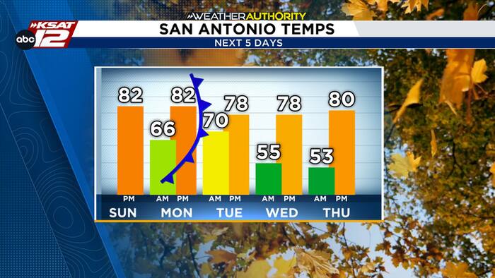
Hope you had a good Halloween! We gained an hour overnight with the end of Daylight Saving Time. The sun will set an hour earlier today, at 5:47 pm.
TODAY
You’ll notice high, thin cirrus clouds today and a bit of humidity. Otherwise, it’ll be warm-ish with a high in the low-80s.
MONDAY NIGHT INTO TUESDAY
Monday’s weather will be similar: Muggy and warm. But, Monday night into Tuesday morning a cool front will sweep across Texas. This will bring severe storms to North Texas and Oklahoma.
Here, in South Central Texas, we’ll be on the tail-end of the system, meaning our storm chance is lower. Still, across the Hill Country and toward the Rio Grande, a broken line of storms will move through from 11 pm Monday to 5 am Tuesday. Along this line, there is a low-end threat for 60-70 mph gusts.

The leftover storms along the front will move through San Antonio early Tuesday, meaning we have a chance for a damp Tuesday morning commute and a few storms at the start of Election Day.
The front will quickly move through, gradually clearing skies, dropping humidity, and making it windy.

Behind the front, the rest of the week will be pleasant! We’ll have mornings in the 50s, afternoons in the 70s, and low humidity.


